

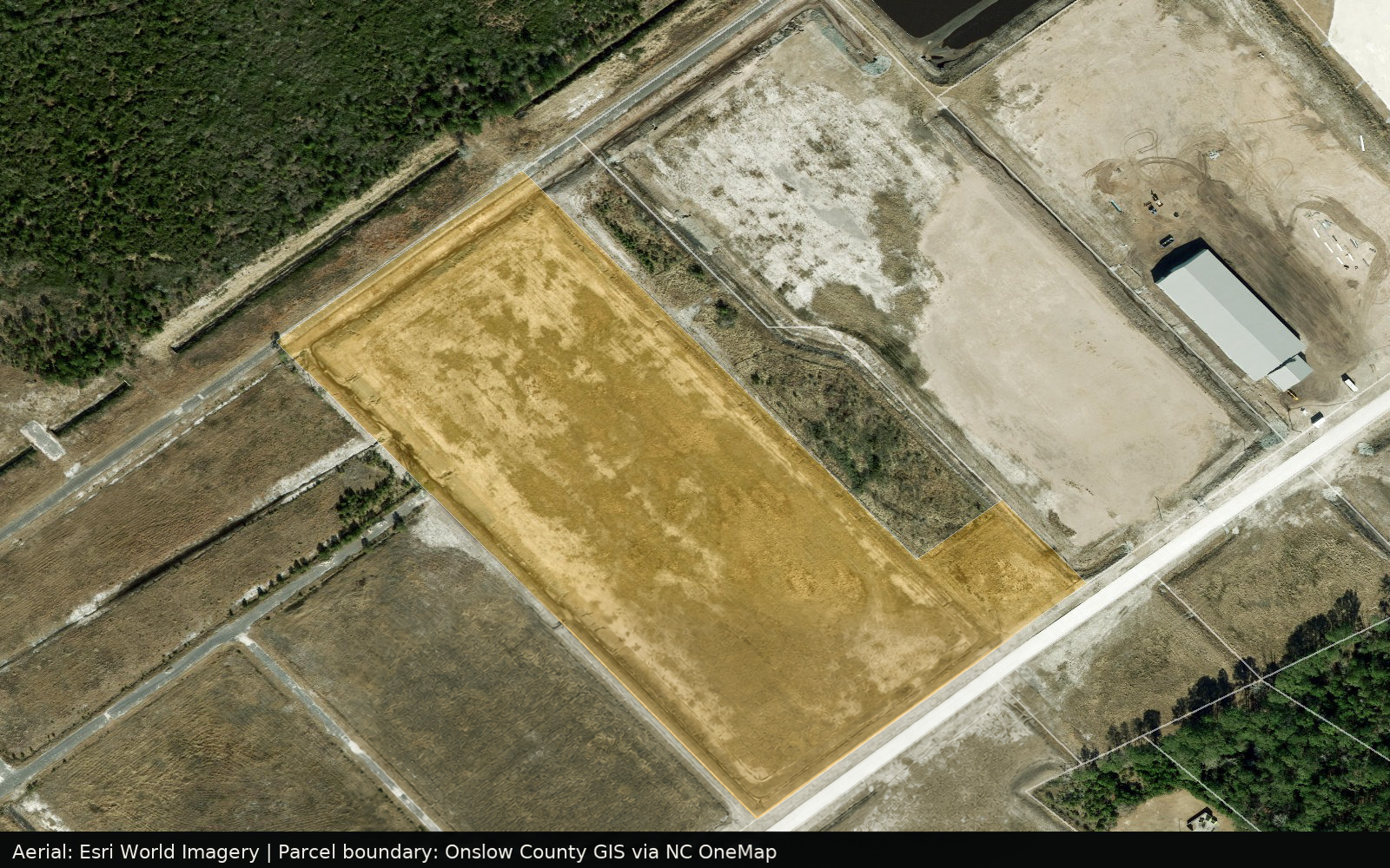
Lot 14 — Camp Davis Industrial Park Phase II
A single light industrial lot inside Camp Davis Phase II — graded, permitted, with water, sewer, electric, and natural gas already stubbed to the curb. Priced at $125,000 per acre.
In the park: Gulfstream Steel & Supply · Onslow Bay Boatworks · Atlantic Seafood
Site & jurisdiction
- Address
- 1000 Betty Taylor Wood Road, Holly Ridge, Onslow County, NC 28445
- Jurisdiction
- Town of Holly Ridge, Onslow County
- Zoning
- Light Industrial
- Lot acreage
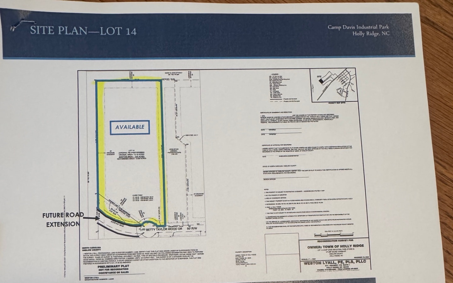
- 12.86 acres
- Direct access
- Frontage on Betty Taylor Wood Road (public, built to Town standards); 0.3 mi to four-lane US Highway 17 via Mabel Rawlinson Drive
- Delivery condition
- Fully permitted and shovel ready at delivery
- Max impervious coverage
- 560,182 SF
- Site control
- Town of Holly Ridge
- Pricing
- $1,607,500 ($125,000/acre)
Utilities & infrastructure
- Water
- Public water, stubbed to the curb
- Wastewater
- Municipal sanitary sewer, stubbed to the curb
- Electric
- Duke Energy
- Natural gas
- Natural gas on site within the park
- Stormwater
- Park stormwater structures constructed as part of Phase II
- Telecom / fiber
- Brightspeed and Spectrum serve Holly Ridge; confirm fiber service and speed at Lot 14
- Water & sewer capacity (GPD)
- Water and sanitary sewer are stubbed to the curb; project-specific capacity confirmed with the Town of Holly Ridge
Access & drive distances
- US Highway 17 (four-lane)
- 0.3 mi via Mabel Rawlinson Drive
- Interstate 40
- 25 minutes by four-lane highway
- Port of Wilmington
- 36 mi — under 1 hour
- Wilmington International Airport
- 40 mi
- Albert J. Ellis Airport
- 30 mi
- Rail (nearest)
- 30 mi — CSX, Wilmington
Due diligence completed
- Permitting
- Phase II construction fully permitted by the Town of Holly Ridge
- Grading & infrastructure
- Grading, stormwater, water, sewer, and road construction complete
- Signalization
- Future traffic signal at US Highway 17 & Mabel Rawlinson Drive approved
- Wetlands, geotech, environmental
- Complete
- Boundary survey
- Complete
Request the full package for Lot 14 · Camp Davis II.
Send us your acreage, power, water, and timeline requirements. We'll return current parcel availability, utility capacity, incentive estimates, and workforce data — confidentially, and usually within two business days.
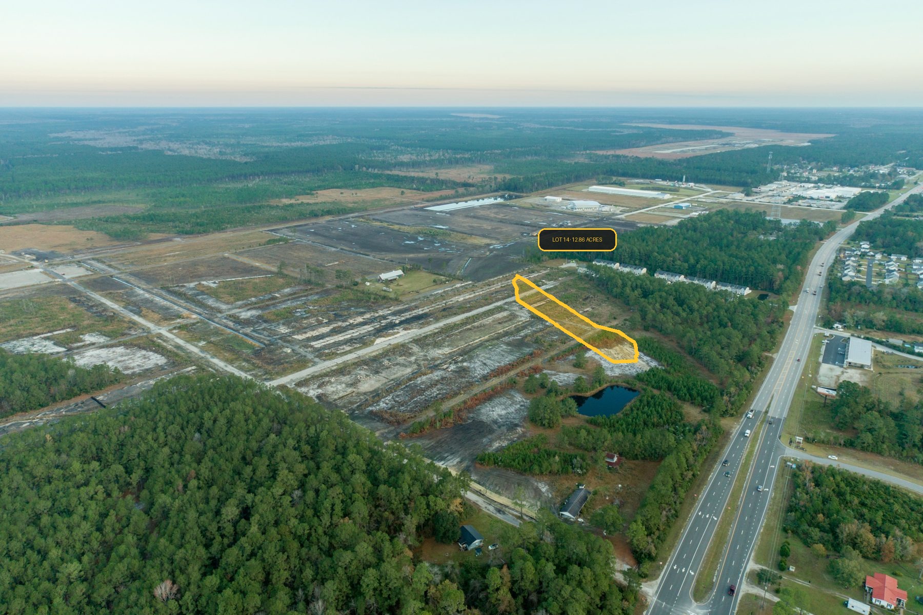
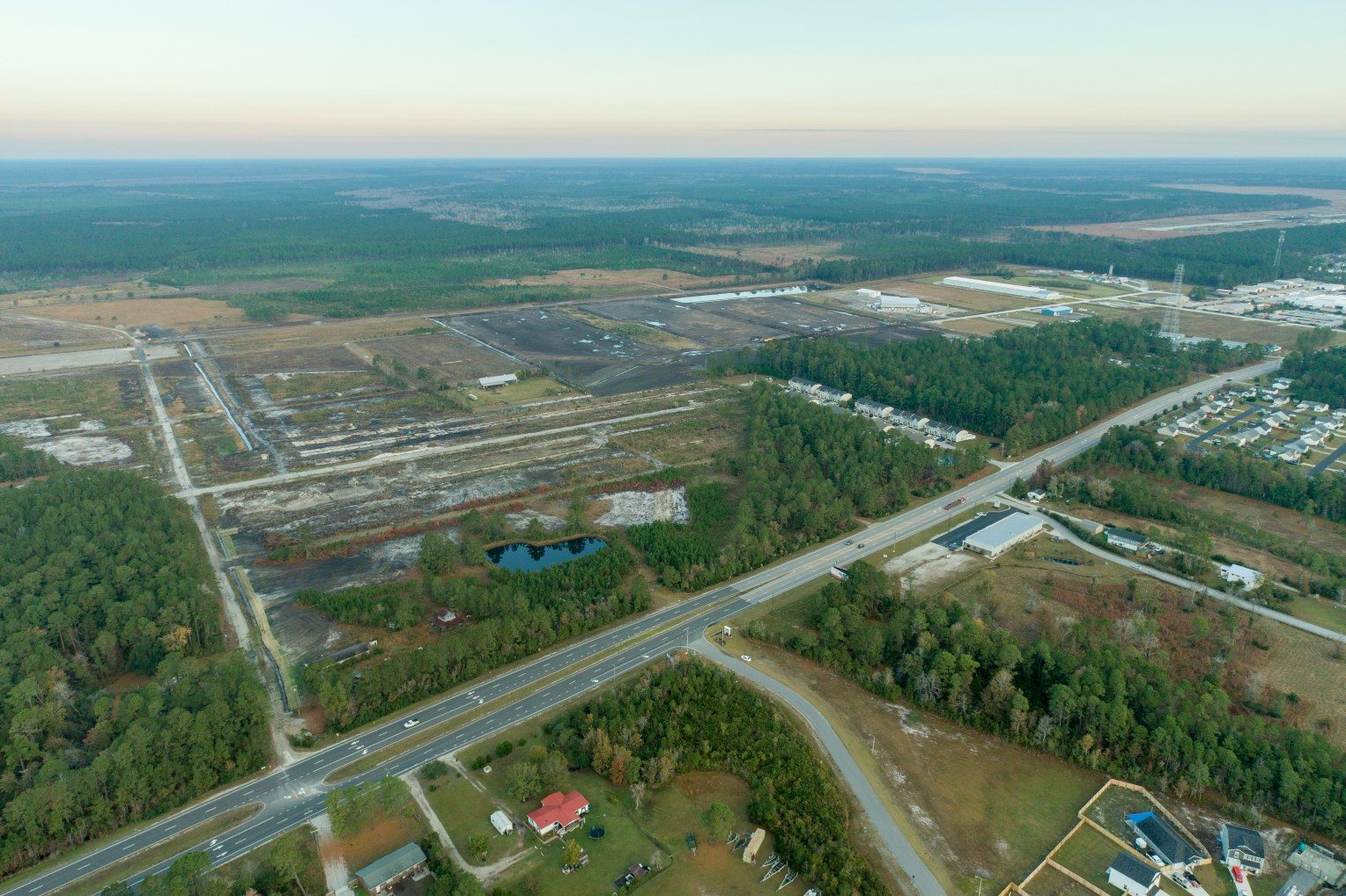
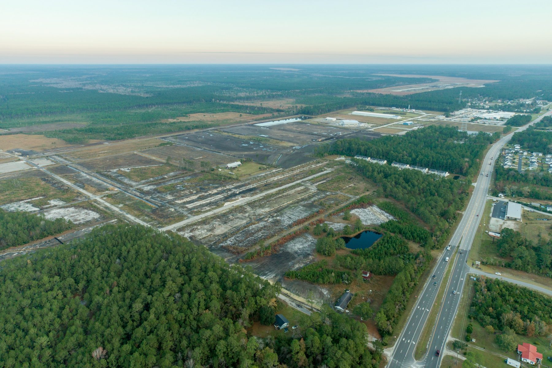
Site imagery
Aerials from the Town of Holly Ridge marketing package for Camp Davis Industrial Park Phase II.
Zoning detail
Permitted uses — CDIP Overlay District
The Camp Davis Industrial Park (CDIP) Overlay accommodates a wide range of assembling, fabricating, manufacturing, and distribution activities. Uses below are drawn from the Town of Holly Ridge Table of Permitted Uses (Zoning Ordinance Section 7-3-26) as amended in 2024 to expand development options in Phase II.
Established overlay uses
- Asphalt products manufacturing
- Bottling plants
- Concrete products production
- Metal machining, welding and fabrication shop
- Metal machining, welding and fabrication plant
- Motor vehicle manufacturing
- Paving and grading operation
- Woodworking fabrication shop / plant
- Refinery
- Wholesale distribution
- Liquor store (ABC store)
- Microbrewery or microdistillery
- Meatpacking and poultry processing plant
- Processing plant (food)
- Accessory structure / use
- Wireless communication facility, small cell / collocation
Uses added by the 2024 text amendment
- Boat repairs, sales, and service
- Industrial supplies and equipment sales
- Monument works / sales
- Mobile vendor
- Truck, farm equipment, heavy equipment sales and service
- Blacksmith operations
- Contractor's office
- Heating and refrigeration repair shop
- Fire and Rescue (EMS)
- Police department
- Truck / freight terminal (6 or fewer trucks)
- Truck / freight terminal (more than 6 trucks)
Source: Town of Holly Ridge Community Development Department. Confirm current use status with the Town before acquisition or design; Onslow Coastal Alliance (OCA) can coordinate a pre-application review.